


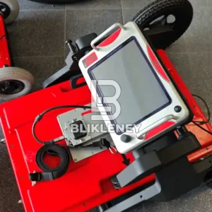
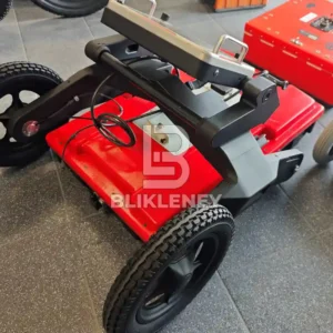
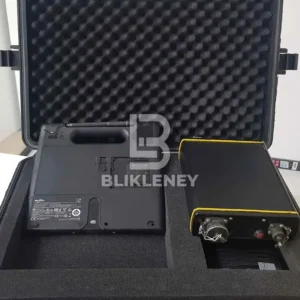
RIS MF Hi-Mod is the all-in-one specialized GPR system capable of investigating large areas, providing a 3D view of the subsoil with a high capability of resolution and penetration depth. IDS Georadar RIS MF Hi-Mod features:
- End to end procedure ensuring professional results in mapping underground utilities and anomalies
- Specific software tools for automatic target recognition and transfer to CAD/GIS maps for high productivity
- Highest detection percentage level, combining longitudinal and transversal scans and several frequencies
- Modular array, easy to set up and reconfigure in the field
RIS MF Hi-Mod Offers
- Consolidated complete procedure from field acquisition to the final output (maps on CAD or GIS);
- Mechanical structure for all urban environments and terrains
- Automatic target recognition, automatic tools help the operator locate pipes and cables
- 2D and 3D tomography: optimised tomography for an immediate visualisation of pipes and cables
- Multi-frequency data fusion: automatic fusion of data from 200 and 600 MHz antennas
- Automatic transfer to CAD/GIS: localized pipes and cables automatically transferred to CAD or GIS maps.
- IQMaps: the post-processing software for faster and smarter GPR data analysis.
You may also be interested in Mala Easy Locator GPR System
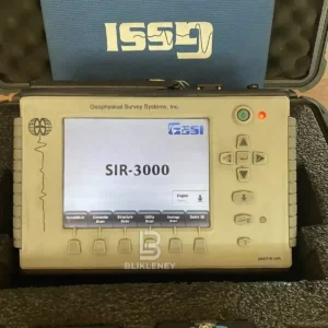
RIS MF Hi-Mod Software
The RIS MF multi-channel – multi frequency data is processed with a dedicated software to fully exploit the system characteristics. Software includes:
- Main processing and interpretation software features the interactive use of multi GPR sections, displays tomographic maps and operates in a CAD environment.
- Relational data base manages the collected data. The software can generate a final CAD cartographic map in 3D containing both surface evidence and GPR interpretation.
- Cross-polar data, a dedicated software uses this data on the post-processing unit to provide information on soil type.
- Cartographic map is automatically generated, containing all the results in cross section and planar view.
OneVision
Providing real-time target viewing, onsite object mapping and GPS navigation, OneVision (available for Stream X, RIS Hi-Pave and RIS Hi-BrigHT) is a software application for advanced GPR data collection This powerful tool can be used with an array of antennas when performing utility mapping, archeological and environmental surveys, and extensive mapping of medium to large size projects.
IQMaps
The latest Ground Penetrating Radar (GPR) data analysis software that improves productivity and provides real time processing and visualisation. IQMaps software provides a step-by-step approach to guide users in performing quick data analysis leveraging a customizable processing and analysis tool for utility mapping.


Reviews
There are no reviews yet.